Throughout history, the establishment of borders and demarcation lines has played a crucial role in shaping the political landscape and territorial sovereignty of nations. These lines often represent complex historical, political, and cultural dynamics between neighboring countries.
Here, we explore some prominent border demarcations, their historical significance, and the impact they have had on international relations.
1. Durand Line (Between: Pakistan and Afghanistan)
The Durand Line, named after Sir Mortimer Durand, is the 2,640-kilometer-long border between Pakistan and Afghanistan. It was demarcated in 1886 when Sir Durand, a British diplomat, negotiated an agreement with Afghanistan’s Amir, Abdur Rahman Khan. The line aimed to establish a buffer zone between British India and Afghanistan to prevent potential Russian influence in the region. However, the Durand Line has been a source of contention between Pakistan and Afghanistan, with Afghanistan not officially recognizing it as the international border.
2. Macmahon Line (Between: India and China)
The Macmahon Line, stretching approximately 1,120 kilometers, was drawn by Sir Henry Macmahon, a British colonial administrator, during the early 20th century. It was intended to delineate the border between British India and Tibet, which was then under Chinese suzerainty. However, China has never accepted the validity of the Macmahon Line and claims vast territories in northeastern India. This dispute has led to a significant strain on India-China relations.
3. Radcliffe Line (Between: India and Pakistan)
Following India’s independence in 1947, the British government appointed Sir Cyril Radcliffe to draw the boundary between India and Pakistan. The Radcliffe Line divided the provinces of Punjab and Bengal along religious lines, creating the separate nations of India and Pakistan. This partition resulted in one of the largest migrations in human history and led to widespread violence and displacement.
4. 17th Parallel (Between: North Vietnam and South Vietnam)
The 17th Parallel served as the demarcation line between North Vietnam and South Vietnam from 1954 to 1976. It was established following the Geneva Accords, which aimed to temporarily divide Vietnam at the end of the First Indochina War. The line played a significant role during the Vietnam War and was eventually dissolved after North Vietnam’s victory in 1975, leading to the reunification of the country.
5. 24th Parallel (Between: India and Pakistan)
The 24th Parallel, also known as the Radcliffe Line in the Kutch region, was drawn during the partition of British India in 1947. The line divided the Kutch region into Indian and Pakistani territories. While Pakistan accepts this line, India has raised concerns over the years about discrepancies and disputes in the region.
6. 38th Parallel (Between: North Korea and South Korea)
The 38th Parallel became the de facto border between North Korea (Democratic People’s Republic of Korea) and South Korea (Republic of Korea) at the end of World War II. It was drawn by the United States and the Soviet Union to divide the Korean Peninsula. The division eventually led to the Korean War in 1950, and the border remains heavily fortified to this day.
7. 49th Parallel (Between: America and Canada)
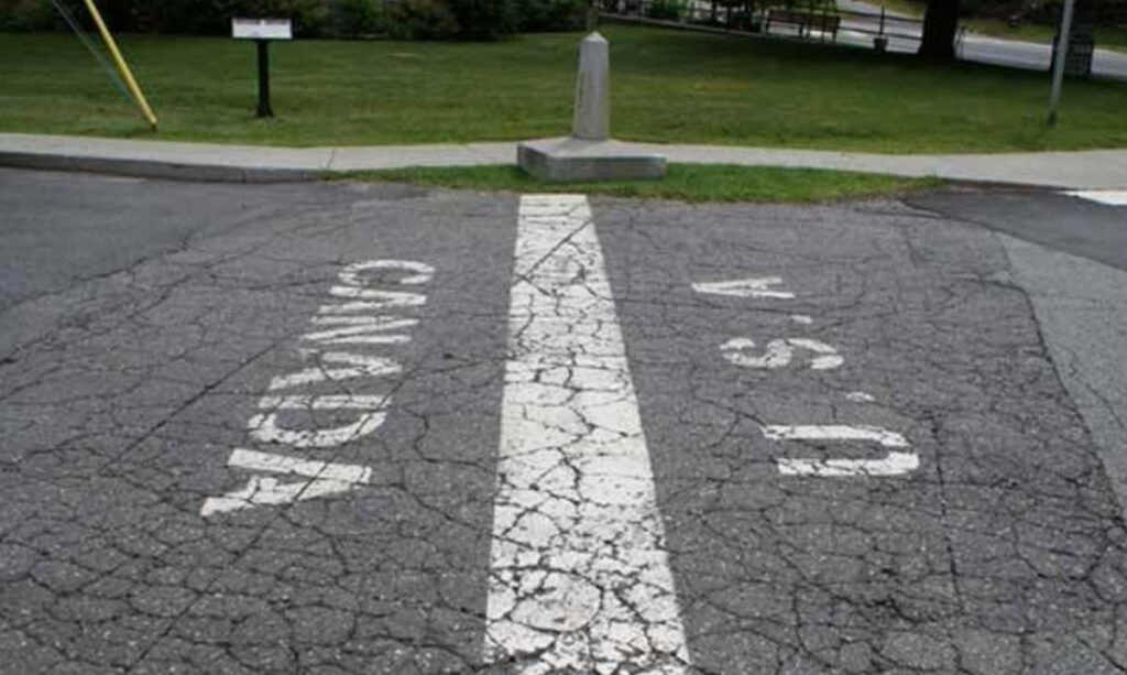
The 49th Parallel serves as part of the border between the United States and Canada. It was established by the 1818 Anglo-American Convention, setting the boundary between the Oregon Country (shared territory) and British North America (Canada). The line later extended to the Pacific Ocean and is now one of the world’s longest international borders, marked by a spirit of peaceful coexistence between the two nations.
8. Hindenburg Line (Between: Germany and Poland)
The Hindenburg Line, also known as the Siegfried Line, was a defensive fortification built by Germany during World War I. It stretched along the western front and aimed to protect German territory from invasion. However, it was eventually breached by Allied forces in 1918, leading to Germany’s defeat.
9. Oder-Neisse Line (Between: Germany and Poland)
The Oder-Neisse Line was established after World War II as the new border between Germany and Poland. The line shifted westward, placing significant portions of former German territories under Polish administration. This change resulted from the redrawing of borders by the victorious Allied powers, which had a profound impact on the demographics and geopolitics of the region.
10. Maginot Line (Between: Germany and France)
Named after French Minister of War André Maginot, the Maginot Line was a defensive barrier constructed by France after World War I. The line aimed to prevent future invasions from Germany. However, during World War II, German forces circumvented the line, leading to France’s swift defeat.
11. Siegfried Line (Between: Germany and France)
The Siegfried Line, known as the Westwall by the Germans, was another defensive fortification built by Germany during World War II. It ran along the western border and was intended to halt any potential invasion from France. However, the line’s impact was limited, and Allied forces eventually broke through, leading to Germany’s defeat.
Border demarcations like these have had profound effects on the histories and relations of the countries involved. While some lines have been accepted and maintained peacefully, others continue to be sources of tension and dispute. The complexity of these geopolitical boundaries reminds us of the significance of diplomacy and the need for peaceful resolution in shaping the future of international relations.


